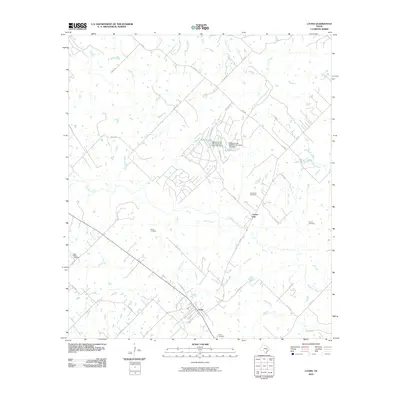
2010 Map of Lyons
USGS Topo · Published 2010About this map
Lyons serves as the primary focal point of this Burleson County landscape, situated at the junction of several rural routes including FM 60 and Co RD 404. The area is defined by a dense network of tributaries that feed into Davidson Creek and Rough Bayou, illustrating a typical East Central Texas drainage pattern. To the north, residential developments are marked by Mallard Lake and Beaver Lake, supported by infrastructure such as Beaver Creek Development Dam Number 3.
Find a feature on this map
44 named features on this map. Tap any name to fly to it.
Don’t see what you’re looking for? This feature index may not catch every label — zoom into the map to look around manually.
Map Details
Editions of this 2010 Lyons Map
This is the sole edition of this map. No revisions or reprints were ever made.
Other maps of this area

1914 · Gay Hill
USGS Topo · 1:62,500

1954 · Austin
USGS Topo · 1:250,000

1956 · Bryan
USGS Topo · 1:62,500

1956 · Caldwell
USGS Topo · 1:62,500

1956 · Somerville
USGS Topo · 1:62,500

1959 · Flag Pond
USGS Topo · 1:24,000

1959 · Gay Hill
USGS Topo · 1:24,000

1959 · Somerville
USGS Topo · 1:24,000

1960 · Lyons
USGS Topo · 1:24,000
1960 · Snook
USGS Topo · 1:24,000