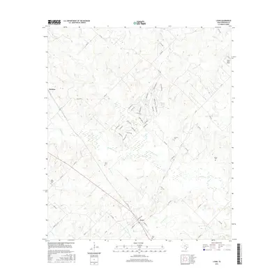
2016 Map of Lyons
USGS Topo · Published 2016About this map
Lyons sits at the junction of FM 60 and several rural roads, anchoring a landscape defined by the winding passage of Davidson Cr and its numerous tributaries. This Burleson County area is marked by a network of family and community history, evidenced by the many small burial grounds such as Lawrence Cem, Pillow Cem, and High Prairie Cem scattered across the countryside. The terrain transitions from the low-lying wetlands of Rough Bayou and Sandy Cr to the more prominent elevations of Beaver Ridge and Berry Ridge. To the north, residential developments like those surrounding Beaver Lake and Mallard Lake contrast with the agricultural expanses and the private Knolle Ranch Airport that characterize the northern reaches of the quadrangle.
Find a feature on this map
70 named features on this map. Tap any name to fly to it.
Don’t see what you’re looking for? This feature index may not catch every label — zoom into the map to look around manually.
Map Details
Editions of this 2016 Lyons Map
This is the sole edition of this map. No revisions or reprints were ever made.
Other maps of this area

1914 · Gay Hill
USGS Topo · 1:62,500

1954 · Austin
USGS Topo · 1:250,000

1956 · Bryan
USGS Topo · 1:62,500

1956 · Caldwell
USGS Topo · 1:62,500

1956 · Somerville
USGS Topo · 1:62,500

1959 · Flag Pond
USGS Topo · 1:24,000

1959 · Gay Hill
USGS Topo · 1:24,000

1959 · Somerville
USGS Topo · 1:24,000

1960 · Lyons
USGS Topo · 1:24,000
1960 · Snook
USGS Topo · 1:24,000