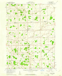
1960 Map of Lyons
USGS Topo · Published 1961About this map
Lyons serves as the primary hub of activity in this northwest Ohio landscape, positioned just south of the border between Michigan and Ohio. This survey captures a rural environment structured by agriculture and early transportation, where the Detroit Toledo and Ironton railroad cuts diagonally across the southern plains near Winameg. The distribution of small community centers like Seward and Advance reflects a settled agricultural history, punctuated by local landmarks that served the surrounding farmsteads.
Find a feature on this map
29 named features on this map. Tap any name to fly to it.
Don’t see what you’re looking for? This feature index may not catch every label — zoom into the map to look around manually.
Map Details
Editions of this 1960 Lyons Map
3 editions found
Other maps of this area

1911 · Wauseon
USGS Topo · 1:62,500

1911 · Swanton
USGS Topo · 1:62,500

1913 · Wauseon
USGS Topo · 1:62,500

1914 · Swanton
USGS Topo · 1:62,500

1939 · Blissfield
USGS Topo · 1:62,500

1941 · Blissfield
USGS Topo · 1:62,500

1943 · Wauseon
USGS Topo · 1:62,500

1953 · Fort Wayne
USGS Topo · 1:250,000

1956 · Fort Wayne
USGS Topo · 1:250,000

1956 · Toledo
USGS Topo · 1:250,000