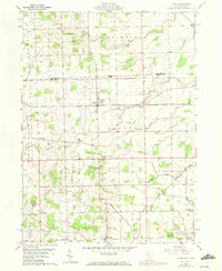
1960 Map of Lyons
USGS Topo · Published 1972About this map
Lyons and the surrounding agricultural townships of Royalton and Chesterfield dominate this survey, which straddles the Michigan-Ohio border. The landscape is defined by a dense network of drainage and small waterways, including Bear Creek, Tenmile Creek, and Bad Creek, alongside the industrial corridor of the Detroit Toledo and Ironton railroad. In the rural sections, the map documents a vanishing era of localized education and worship, with sites like Pratt Sch, Tubbs Sch, and the Beulah Ch serving isolated farmsteads. The settlement at Winameg and the crossroads at Seward illustrate the traditional village clusters that persisted into the early 1960s. Genealogists will find particular value in the precisely marked family and community burial grounds, such as Rose Hill Cem, Edgar Cem, and Aetna Cem.
Find a feature on this map
31 named features on this map. Tap any name to fly to it.
Don’t see what you’re looking for? This feature index may not catch every label — zoom into the map to look around manually.
Map Details
Editions of this 1960 Lyons Map
3 editions found
Other maps of this area

1911 · Wauseon
USGS Topo · 1:62,500

1911 · Swanton
USGS Topo · 1:62,500

1913 · Wauseon
USGS Topo · 1:62,500

1914 · Swanton
USGS Topo · 1:62,500

1939 · Blissfield
USGS Topo · 1:62,500

1941 · Blissfield
USGS Topo · 1:62,500

1943 · Wauseon
USGS Topo · 1:62,500

1953 · Fort Wayne
USGS Topo · 1:250,000

1956 · Fort Wayne
USGS Topo · 1:250,000

1956 · Toledo
USGS Topo · 1:250,000