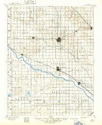
1894 Map of Lyons
USGS Topo · Published 1949About this map
The Arkansas River cuts diagonally through the heart of Rice County, defining a landscape of transition between the river bottomlands and the surrounding prairie uplands. Surveyed in the late 19th century, this map documents the critical intersection of major transit lines, including the Atchison Topeka and Santa Fe Railroad and the Missouri Pacific Railroad, which fueled the growth of central hubs like Lyons and Sterling. The geography is marked by distinctive hydrological features such as the Black Marsh and Salt Marsh, highlighting the varied terrain that early settlers encountered. Genealogists and researchers can find smaller, vanished-interest points like Huntsville P.O. and early rail stops at Mitchell and Chase. The map also illustrates the early township structure, from Eureka in the north to Salt Creek in the south, reflecting the organized settlement patterns of the Kansas plains during this era of agricultural expansion.
Find a feature on this map
53 named features on this map. Tap any name to fly to it.
Don’t see what you’re looking for? This feature index may not catch every label — zoom into the map to look around manually.
Map Details
Editions of this 1894 Lyons Map
5 editions found

Other maps of this area

1889 · Cheney
USGS Topo · 1:125,000

1891 · Great Bend
USGS Topo · 1:125,000

1891 · Hutchinson
USGS Topo · 1:125,000

1891 · Cheney
USGS Topo · 1:125,000

1892 · Salina
USGS Topo · 1:125,000

1892 · Kingman
USGS Topo · 1:125,000

1892 · Pratt
USGS Topo · 1:125,000

1893 · Great Bend
USGS Topo · 1:125,000

1893 · Hutchinson
USGS Topo · 1:125,000

1894 · Ellsworth
USGS Topo · 1:125,000