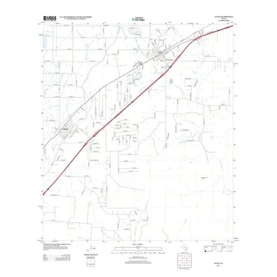
2013 Map of Lytle
USGS Topo · Published 2013About this map
Lytle and Natalia anchor this South Texas landscape, where the agricultural legacy of the Natalia Canal intersects with the industrial footprint of the Verna-Anacacho Oil Field. The terrain is defined by a dense network of seasonal drainages, including Fort Ewell Cr, Chacon Cr, and the various branches of the Atascosa River, such as the Spring Atascosa River and the W Prong Atascosa River. These watercourses dictate the historical settlement patterns, with roads like FM-463 and Co RD-6710 following the higher ground between the creek beds.
Find a feature on this map
122 named features on this map. Tap any name to fly to it.
Don’t see what you’re looking for? This feature index may not catch every label — zoom into the map to look around manually.
Map Details
Editions of this 2013 Lytle Map
This is the sole edition of this map. No revisions or reprints were ever made.
Other maps of this area

1942 · Natalia
USGS Topo · 1:62,500

1953 · Macdona
USGS Topo · 1:24,000

1954 · San Antonio
USGS Topo · 1:250,000

1957 · San Antonio
USGS Topo · 1:250,000

1958 · La Coste
USGS Topo · 1:24,000

1958 · Somerset
USGS Topo · 1:24,000

1964 · Ghost Hill
USGS Topo · 1:24,000

1964 · Castroville
USGS Topo · 1:24,000

1964 · Devine
USGS Topo · 1:24,000
1964 · Lytle
USGS Topo · 1:24,000