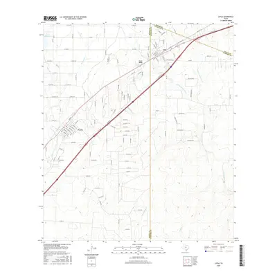
2016 Map of Lytle
USGS Topo · Published 2016About this map
Lytle and Natalia anchor this south-central Texas landscape, situated where the borders of Medina, Atascosa, and Bexar counties converge. The region is defined by a sophisticated water management network, most notably the Natalia Canal which draws from the Chacon Reservoir to the northwest. This infrastructure supports the agricultural transitions between Fort Ewell Cr and the multiple branches of the Atascosa River, including the W Prong Atascosa River and N Prong Atascosa River.
Find a feature on this map
122 named features on this map. Tap any name to fly to it.
Don’t see what you’re looking for? This feature index may not catch every label — zoom into the map to look around manually.
Map Details
Editions of this 2016 Lytle Map
This is the sole edition of this map. No revisions or reprints were ever made.
Other maps of this area

1942 · Natalia
USGS Topo · 1:62,500

1953 · Macdona
USGS Topo · 1:24,000

1954 · San Antonio
USGS Topo · 1:250,000

1957 · San Antonio
USGS Topo · 1:250,000

1958 · La Coste
USGS Topo · 1:24,000

1958 · Somerset
USGS Topo · 1:24,000

1964 · Ghost Hill
USGS Topo · 1:24,000

1964 · Castroville
USGS Topo · 1:24,000

1964 · Devine
USGS Topo · 1:24,000
1964 · Lytle
USGS Topo · 1:24,000