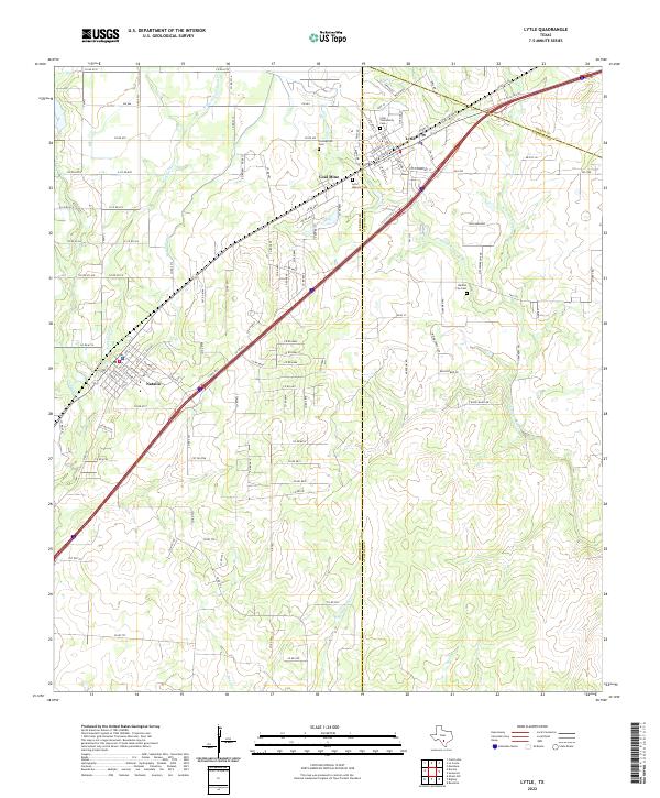
2022 Map of Lytle
USGS Topo · Published 2022About this map
Lytle and Natalia serve as the primary anchors for this region southwest of San Antonio, where the landscape transitions into the brush country of Atascosa and Medina counties. The map captures a complex network of ranch and farm-to-market roads, such as Co RD 6710 and FM 463, that connect dispersed rural homesteads and agricultural tracts. A notable industrial marker is the Coal Mine located between the two main settlements, reflecting the subsurface history of the Lytle area.
Find a feature on this map
109 named features on this map. Tap any name to fly to it.
Don’t see what you’re looking for? This feature index may not catch every label — zoom into the map to look around manually.
Map Details
Editions of this 2022 Lytle Map
This is the sole edition of this map. No revisions or reprints were ever made.
Other maps of this area

1942 · Natalia
USGS Topo · 1:62,500

1953 · Macdona
USGS Topo · 1:24,000

1954 · San Antonio
USGS Topo · 1:250,000

1957 · San Antonio
USGS Topo · 1:250,000

1958 · La Coste
USGS Topo · 1:24,000

1958 · Somerset
USGS Topo · 1:24,000

1964 · Ghost Hill
USGS Topo · 1:24,000

1964 · Castroville
USGS Topo · 1:24,000

1964 · Devine
USGS Topo · 1:24,000
1964 · Lytle
USGS Topo · 1:24,000