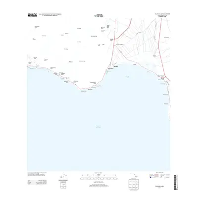
2013 Map of Maalaea
USGS Topo · Published 2013About this map
Ma'alaea Bay dominates this coastal landscape, where the rugged volcanic slopes of West Maui meet the central valley. The settlement of Ma'alaea serves as a focal point along the shoreline, situated near the protected waters of Kealia Pond. This era shows a transition between the natural coastal ecology and modern infrastructure, evidenced by the presence of the Maui Drag Strip and the Puu Hele Cinder Pit inland.
Find a feature on this map
62 named features on this map. Tap any name to fly to it.
Don’t see what you’re looking for? This feature index may not catch every label — zoom into the map to look around manually.
Map Details
Editions of this 2013 Maalaea Map
This is the sole edition of this map. No revisions or reprints were ever made.
Other maps of this area

1929 · Kahoolawe
USGS Topo · 1:62,500

1954 · Maui
USGS Topo · 1:250,000

1954 · Maalaea
USGS Topo · 1:24,000

1954 · Paia
USGS Topo · 1:24,000

1954 · Puu O Kali
USGS Topo · 1:24,000

1954 · Makena
USGS Topo · 1:24,000

1955 · Olowalu
USGS Topo · 1:24,000

1955 · Wailuku
USGS Topo · 1:24,000

1956 · Lahaina
USGS Topo · 1:24,000

1966 · Maui
USGS Topo · 1:250,000