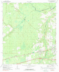
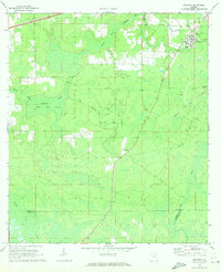
1972 Map of Macclenny West
USGS Topo · Published 1973About this map
The St Marys River forms a winding natural boundary between Florida and Georgia at the northern edge of this landscape, where the Baker and Charlton County lines meet. This territory is characterized by a mix of wetlands and rural settlements, with Hells Bay and the South Prong St Marys River defining the drainage patterns. The Seaboard Coast Line railroad serves as the primary east-west corridor, connecting the communities of Glen St Mary, Margaretta, and the western portion of Macclenny. These towns evolved alongside the rail infrastructure, which supported local industries like the Resin collection point. Local social life is mapped through a network of rural institutions, including Oak Grove Ch, Macedonia Ch, and Keller High Sch. Significant topographic markers such as Pine Top and the Lookout Tower punctuate the flat, creek-crossed terrain of the southern coastal plain.
Find a feature on this map
33 named features on this map. Tap any name to fly to it.
Don’t see what you’re looking for? This feature index may not catch every label — zoom into the map to look around manually.
Map Details
Editions of this 1972 Macclenny West Map
3 editions found
Other maps of this area

1917 · Macclenny
USGS Topo · 1:62,500

1918 · Lawtey
USGS Topo · 1:62,500

1918 · Macclenny
USGS Topo · 1:62,500

1954 · Valdosta
USGS Topo · 1:250,000

1958 · Valdosta
USGS Topo · 1:250,000

1959 · Valdosta
USGS Topo · 1:250,000

1963 · Sanderson South
USGS Topo · 1:24,000

1969 · Sanderson North
USGS Topo · 1:24,000
1969 · Taylor
USGS Topo · 1:24,000
1970 · Manning
USGS Topo · 1:24,000