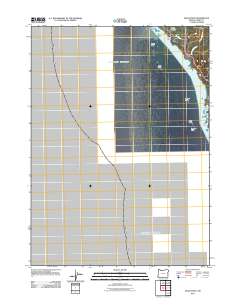
2011 Map of Mack Point
USGS Topo · Published 2011About this map
Mack Point and the nearby Mack Reef define this dramatic stretch of the Southern Oregon coast where the land meets the Pacific Ocean. This coastal landscape is marked by a series of prominent sea stacks and geological formations including Mack Arch, Saddle Rock, and Yellow Rock. The topography is defined by steep drainage patterns like Long Hollow and the outflow of Burnt Hill Creek, which cuts through the shoreline before reaching the sea. Access to this portion of the Curry County coast is traced through Byrdies Rd and the winding Carpenterville Rd, which parallels the coastline. The map records several named landmarks used for navigation and coastal identification, including Black Rock, Leaning Rock, and the appropriately named Windy Point.
Find a feature on this map
15 named features on this map. Tap any name to fly to it.
Don’t see what you’re looking for? This feature index may not catch every label — zoom into the map to look around manually.
Map Details
Editions of this 2011 Mack Point Map
This is the sole edition of this map. No revisions or reprints were ever made.
Other maps of this area

1954 · Coos Bay
USGS Topo · 1:250,000

1954 · Cape Ferrelo
USGS Topo · 1:62,500

1954 · Gold Beach
USGS Topo · 1:62,500

1958 · Coos Bay
USGS Topo · 1:250,000

1962 · Coos Bay
USGS Topo · 1:250,000
1985 · Mack Point
USGS Topo · 1:24,000
1986 · Carpenterville
USGS Topo · 1:24,000
1986 · Brookings
USGS Topo · 1:24,000
1986 · Sundown Mtn
USGS Topo · 1:24,000
1986 · Cape Sebastian
USGS Topo · 1:24,000