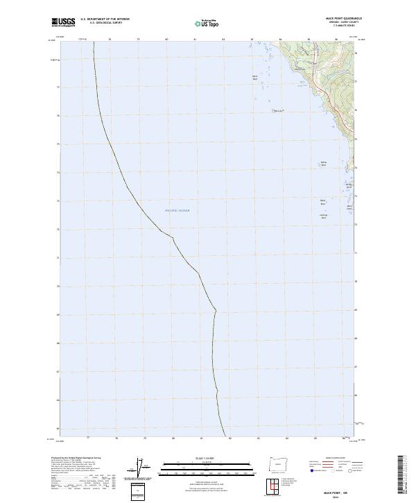
2024 Map of Mack Point
USGS Topo · Published 2024About this map
Oregon Islands National Wildlife Refuge and the Oregon Islands Wilderness dominate this coastal section of Curry County, protecting a dramatic series of offshore sea stacks and reefs. The landscape is defined by the immediate meeting of the Pacific Ocean and a steep shoreline, where landmarks such as Mack Arch and Mack Reef provide critical habitat and navigation points. Small coves like Mack Arch Cove and freshwater drainage from Burnt Hill Creek indicate the rugged nature of the coastline, which remains largely undeveloped.
Find a feature on this map
19 named features on this map. Tap any name to fly to it.
Don’t see what you’re looking for? This feature index may not catch every label — zoom into the map to look around manually.
Map Details
Editions of this 2024 Mack Point Map
This is the sole edition of this map. No revisions or reprints were ever made.
Other maps of this area

1954 · Coos Bay
USGS Topo · 1:250,000

1954 · Cape Ferrelo
USGS Topo · 1:62,500

1954 · Gold Beach
USGS Topo · 1:62,500

1958 · Coos Bay
USGS Topo · 1:250,000

1962 · Coos Bay
USGS Topo · 1:250,000
1985 · Mack Point
USGS Topo · 1:24,000
1986 · Carpenterville
USGS Topo · 1:24,000
1986 · Brookings
USGS Topo · 1:24,000
1986 · Sundown Mtn
USGS Topo · 1:24,000
1986 · Cape Sebastian
USGS Topo · 1:24,000