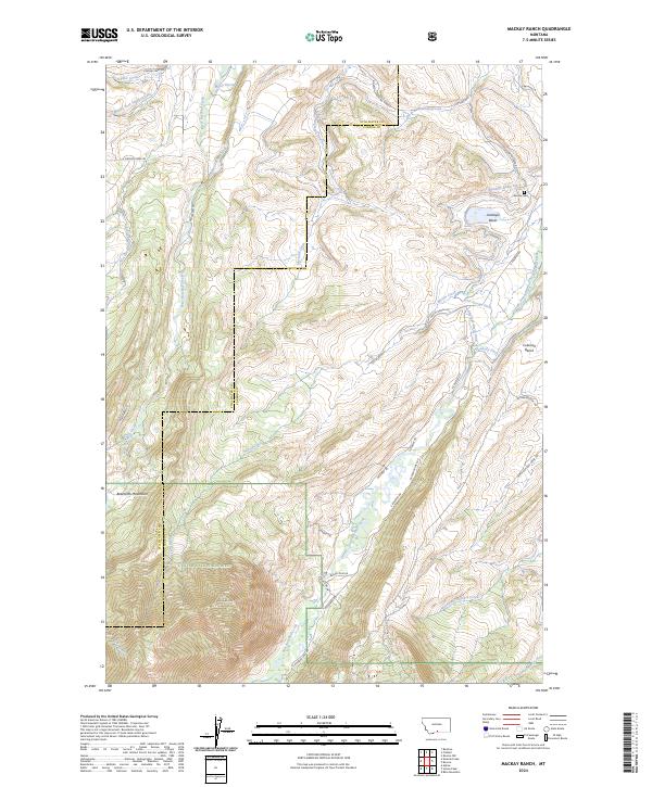
2024 Map of Mackay Ranch
USGS Topo · Published 2024About this map
The Absaroka-Beartooth Wilderness dominates the southwestern corner of this quadrangle, where the steep slopes of the Beartooth Mountains rise sharply above the river valleys. A complex network of irrigation infrastructure, including the Oakley-Parker Ditch, John George Ditch, and Peabody Ditch, crisscrosses the lower elevations, reflecting the critical role of water management in the ranching economy of Stillwater and Carbon counties.
Find a feature on this map
50 named features on this map. Tap any name to fly to it.
Don’t see what you’re looking for? This feature index may not catch every label — zoom into the map to look around manually.
Map Details
Editions of this 2024 Mackay Ranch Map
This is the sole edition of this map. No revisions or reprints were ever made.
Other maps of this area

1898 · Granite Mountain District
USGS Topo · 1:125,000

1932 · Red Lodge No 2
USGS Topo · 1:48,000

1932 · Nye No 1
USGS Topo · 1:48,000

1954 · Billings
USGS Topo · 1:250,000
1956 · Emerald Lake
USGS Topo · 1:24,000
1956 · Fishtail
USGS Topo · 1:24,000

1956 · Roscoe
USGS Topo · 1:24,000

1956 · Alpine
USGS Topo · 1:62,500

1956 · Mackay Ranch
USGS Topo · 1:24,000

1956 · Roscoe NW
USGS Topo · 1:24,000