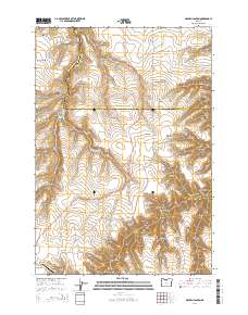
2014 Map of Macken Canyon
USGS Topo · Published 2014About this map
Shaniko anchors the southwest corner of this high-plateau landscape, where the agricultural and aviation hub of the Shaniko Ranch Airport sits near the head of a complex drainage network. The terrain is defined by a series of deep canyons and hollows that carve through the border between Wasco and Sherman counties. The primary drainage of Buck Hollow Cr is fed by numerous tributaries including Burgess Canyon and Thompson Canyon, leading toward the prominent Macken Canyon in the north.
Find a feature on this map
36 named features on this map. Tap any name to fly to it.
Don’t see what you’re looking for? This feature index may not catch every label — zoom into the map to look around manually.
Map Details
Editions of this 2014 Macken Canyon Map
This is the sole edition of this map. No revisions or reprints were ever made.
Other maps of this area

1953 · The Dalles
USGS Topo · 1:250,000

1955 · Bend
USGS Topo · 1:250,000

1956 · The Dalles
USGS Topo · 1:250,000

1957 · Bend
USGS Topo · 1:250,000

1957 · The Dalles
USGS Topo · 1:250,000

1958 · Bend
USGS Topo · 1:250,000

1966 · Antelope
USGS Topo · 1:62,500

1966 · Willowdale
USGS Topo · 1:62,500

1970 · Kent
USGS Topo · 1:24,000

1970 · Macken Canyon
USGS Topo · 1:24,000