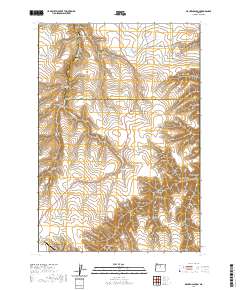
2020 Map of Macken Canyon
USGS Topo · Published 2020About this map
Shaniko anchors the southwestern corner of this survey, where the dry plateau of the eastern Cascades meets the complex drainage system of the Buck Hollow Cr. The landscape is defined by an intricate network of erosional features, from the eponymous Macken Canyon to smaller draws like Moonshine Canyon and May Canyon. This area, split by the boundary between Wasco and Sherman counties, reflects a rugged ranching economy centered around water sources like Kelsey Spring and Taylor Springs. The presence of the Shaniko Ranch Airport alongside traditional landmarks such as Taylor Point illustrates the modernization of transport in this traditionally remote high-desert environment. Much of the northern reach is occupied by deeply incised terrain like Kibby Canyon and Burgess Canyon, demonstrating the significant elevation changes that historically funneled travel along specific ridges and gulches.
Find a feature on this map
37 named features on this map. Tap any name to fly to it.
Don’t see what you’re looking for? This feature index may not catch every label — zoom into the map to look around manually.
Map Details
Editions of this 2020 Macken Canyon Map
This is the sole edition of this map. No revisions or reprints were ever made.
Other maps of this area

1953 · The Dalles
USGS Topo · 1:250,000

1955 · Bend
USGS Topo · 1:250,000

1956 · The Dalles
USGS Topo · 1:250,000

1957 · Bend
USGS Topo · 1:250,000

1957 · The Dalles
USGS Topo · 1:250,000

1958 · Bend
USGS Topo · 1:250,000

1966 · Antelope
USGS Topo · 1:62,500

1966 · Willowdale
USGS Topo · 1:62,500

1970 · Kent
USGS Topo · 1:24,000

1970 · Macken Canyon
USGS Topo · 1:24,000