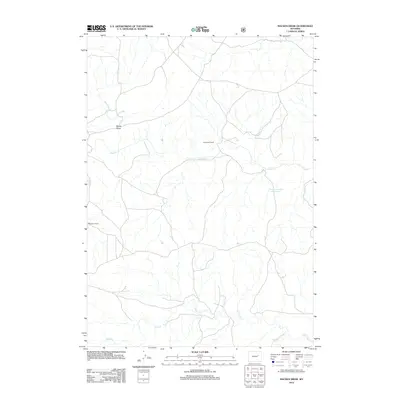
2012 Map of Macken Draw
USGS Topo · Published 2012About this map
Fred Taylor Ranch and the WG Taylor Ranch anchor this landscape in Campbell County, showing the persistent ranching footprints of the high plains. The drainage network is the defining characteristic of this terrain, with seasonal watercourses like Ninemile Cr and Antelope Cr carving the land. Significant topographic features such as Moyer Draw and the winding course of Sand Cr illustrate the complex hydrology that ranchers relied upon. The presence of the Jenson Number 1 Reservoir highlights the critical importance of water management in this arid environment, providing a focal point for land use near the junction of Stinking Water Cr. This map captures the intersection of family-named landmarks and the natural drainages that have dictated the settlement patterns of the Wyoming prairie.
Find a feature on this map
9 named features on this map. Tap any name to fly to it.
Don’t see what you’re looking for? This feature index may not catch every label — zoom into the map to look around manually.
Map Details
Editions of this 2012 Macken Draw Map
This is the sole edition of this map. No revisions or reprints were ever made.
Other maps of this area

1954 · Pine Tree
USGS Topo · 1:24,000

1955 · Newcastle
USGS Topo · 1:250,000

1958 · Newcastle
USGS Topo · 1:250,000

1959 · Coal Draw
USGS Topo · 1:62,500

1960 · Ross
USGS Topo · 1:62,500

1960 · Turnercrest
USGS Topo · 1:62,500

1974 · Reno Junction
USGS Topo · 1:100,000

1979 · Bill
USGS Topo · 1:100,000

1984 · Turnercrest
USGS Topo · 1:24,000
1984 · Coal Draw North
USGS Topo · 1:24,000