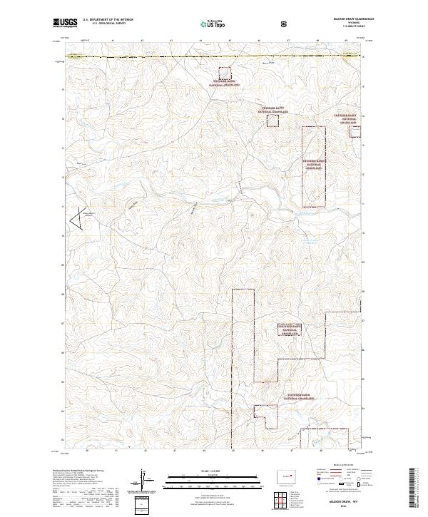
2021 Map of Macken Draw
USGS Topo · Published 2021About this map
Thunder Basin National Grassland dominates this high plains landscape along the Campbell and Converse County border. The map reveals a land defined by its drainage systems, where seasonal watercourses like Macken Draw, Buck Draw, and Phillips Draw carve through the prairie towards larger tributaries such as Antelope Creek and Ninemile Cr. This modern survey illustrates the sparse human footprint on the Wyoming ranching country, centered around infrastructure like the Moore Ranch Airport and remote water management sites including Jenson Number 1 Reservoir. The intricate network of township and range lines, such as t40n r74w and t40n r73w, provides a precise grid for locating specific land parcels and historical ranching boundaries. Long stretches of Turner Crest Rd serve as the primary conduits through these grasslands, connecting isolated water sources like Sand Cr and Stinking Water Cr across the rolling topography.
Find a feature on this map
21 named features on this map. Tap any name to fly to it.
Don’t see what you’re looking for? This feature index may not catch every label — zoom into the map to look around manually.
Map Details
Editions of this 2021 Macken Draw Map
This is the sole edition of this map. No revisions or reprints were ever made.
Other maps of this area

1954 · Pine Tree
USGS Topo · 1:24,000

1955 · Newcastle
USGS Topo · 1:250,000

1958 · Newcastle
USGS Topo · 1:250,000

1959 · Coal Draw
USGS Topo · 1:62,500

1960 · Ross
USGS Topo · 1:62,500

1960 · Turnercrest
USGS Topo · 1:62,500

1974 · Reno Junction
USGS Topo · 1:100,000

1979 · Bill
USGS Topo · 1:100,000

1984 · Turnercrest
USGS Topo · 1:24,000
1984 · Coal Draw North
USGS Topo · 1:24,000