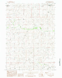
1984 Map of Macken Draw
USGS Topo · Published 1984About this map
Antelope Creek and Macken Draw define the drainage patterns of this high plains landscape along the border of Campbell and Converse counties. Published in the mid-1980s, the map reveals a sparsely populated ranching or grazing territory where water sources are the primary landmarks. Essential water features like Eagle Nest Spring and the man-made Woods Reservoir stand out against a backdrop of complex draws and intermittent streams. The terrain is characterized by a series of significant seasonal watercourses, including Moyer Draw, Ninemile Draw, and Phillips Draw, which suggest the episodic nature of water movement in this arid environment. The presence of Stinking Water Creek and Sand Creek in the southern portion of the quadrangle further illustrates the geographical naming conventions rooted in the physical properties of the local hydrology and soil.
Find a feature on this map
11 named features on this map. Tap any name to fly to it.
Don’t see what you’re looking for? This feature index may not catch every label — zoom into the map to look around manually.
Map Details
Editions of this 1984 Macken Draw Map
This is the sole edition of this map. No revisions or reprints were ever made.
Other maps of this area

1954 · Pine Tree
USGS Topo · 1:24,000

1955 · Newcastle
USGS Topo · 1:250,000

1958 · Newcastle
USGS Topo · 1:250,000

1959 · Coal Draw
USGS Topo · 1:62,500

1960 · Ross
USGS Topo · 1:62,500

1960 · Turnercrest
USGS Topo · 1:62,500

1974 · Reno Junction
USGS Topo · 1:100,000

1979 · Bill
USGS Topo · 1:100,000

1984 · Turnercrest
USGS Topo · 1:24,000
1984 · Coal Draw North
USGS Topo · 1:24,000