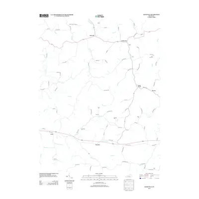
2013 Map of Mackville
USGS Topo · Published 2013About this map
Mackville and Jenkinsville anchor the northern landscape of this region, where the terrain is carved by the winding paths of Taylors Fork and Long Lick Cr. The area is notably dense with family-named cemeteries, suggesting a deep generational connection to the land through sites like Mc Mullin Cem, Bottom Cem, and Cull Cem. These small burial grounds are scattered along rural routes such as James Russell RD and Humes RD, marking the historical footprints of early settlers. To the south, the settlements of Texas and Pottsville sit along the corridor following the E Fork Beech Fork, where the landscape transitions into more significant drainage basins like Stone Lick and Turkey Cr. The presence of several Russell Cem locations and the Cocanougher Cem illustrates the localized heritage of Washington County, while roads like Battlefield RD near Stewart hint at the historical movements through this part of Kentucky.
Find a feature on this map
86 named features on this map. Tap any name to fly to it.
Don’t see what you’re looking for? This feature index may not catch every label — zoom into the map to look around manually.
Map Details
Editions of this 2013 Mackville Map
This is the sole edition of this map. No revisions or reprints were ever made.
Other maps of this area

1905 · Harrodsburg
USGS Topo · 1:125,000

1952 · Perryville
USGS Topo · 1:24,000

1952 · Cornishville
USGS Topo · 1:24,000

1952 · Parksville
USGS Topo · 1:24,000

1953 · Mackville
USGS Topo · 1:24,000

1953 · Brush Grove
USGS Topo · 1:24,000

1953 · Gravel Switch
USGS Topo · 1:24,000

1953 · Lebanon East
USGS Topo · 1:24,000

1953 · Cardwell
USGS Topo · 1:24,000

1953 · Springfield
USGS Topo · 1:24,000