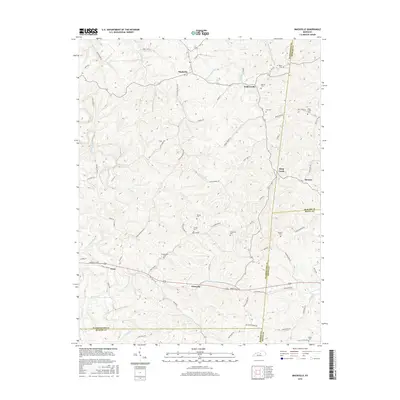
2016 Map of Mackville
USGS Topo · Published 2016About this map
Mackville and Pottsville anchor this 2016 survey of the central Kentucky landscape where Washington, Mercer, Boyle, and Marion Counties meet. The map reveals a highly dissected terrain defined by the drainage of Beech Fork and Long Lick Cr, with narrow ridge roads connecting small farming settlements. Notable for genealogists is the high density of small family-named burial grounds, such as Mc Mullin Cem, Holderman Cem, and Young Cem, which are scattered throughout the hills. The settlement at Texas sits at the intersection of Perryville Rd and Texas Loop Rd, illustrating the rural transportation network that has defined the region for generations. A clear boundary line marks the transitions between counties, following natural features like Deep Cr and established survey lines across the upland ridges.
Find a feature on this map
85 named features on this map. Tap any name to fly to it.
Don’t see what you’re looking for? This feature index may not catch every label — zoom into the map to look around manually.
Map Details
Editions of this 2016 Mackville Map
This is the sole edition of this map. No revisions or reprints were ever made.
Other maps of this area

1905 · Harrodsburg
USGS Topo · 1:125,000

1952 · Perryville
USGS Topo · 1:24,000

1952 · Cornishville
USGS Topo · 1:24,000

1952 · Parksville
USGS Topo · 1:24,000

1953 · Mackville
USGS Topo · 1:24,000

1953 · Brush Grove
USGS Topo · 1:24,000

1953 · Gravel Switch
USGS Topo · 1:24,000

1953 · Lebanon East
USGS Topo · 1:24,000

1953 · Cardwell
USGS Topo · 1:24,000

1953 · Springfield
USGS Topo · 1:24,000