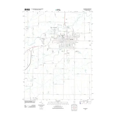
2012 Map of Macomb
USGS Topo · Published 2012About this map
Western Illinois University dominates the northwestern sector of the city, serving as a focal point for the academic and residential layout of modern Macomb. The surrounding neighborhoods include University Village, East Village, and Lamone Village, illustrating the post-war expansion of the campus area. For genealogists and local historians, this map is particularly dense with burial grounds, ranging from the central Old Macomb Cem and Old Catholic Cem to rural outliers like Bailey Cem, Strader Cem, and Wayland Cem in the southern reaches of the quadrangle.
Find a feature on this map
127 named features on this map. Tap any name to fly to it.
Don’t see what you’re looking for? This feature index may not catch every label — zoom into the map to look around manually.
Map Details
Editions of this 2012 Macomb Map
This is the sole edition of this map. No revisions or reprints were ever made.
Other maps of this area

1912 · Macomb
USGS Topo · 1:62,500

1913 · Colchester
USGS Topo · 1:62,500

1914 · Macomb
USGS Topo · 1:62,500

1916 · Good Hope
USGS Topo · 1:62,500

1918 · La Harpe
USGS Topo · 1:62,500

1918 · Good Hope
USGS Topo · 1:62,500

1958 · Burlington
USGS Topo · 1:250,000

1961 · Burlington
USGS Topo · 1:250,000

1963 · Burlington
USGS Topo · 1:250,000
1974 · Doddsville
USGS Topo · 1:24,000