
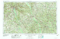
1964 Map of Macon
USGS Topo · Published 1964About this map
Macon serves as the urban anchor of this mid-century landscape, where the Ocmulgee River and Oconee River dominate the drainage patterns of central Georgia. The map captures a moment of significant military and economic presence at Robins AFB and Warner Robins just as the regional road network, including U S 80 and U S 341, was consolidating the connection between rural agricultural centers and industrial hubs.
Find a feature on this map
215 named features on this map. Tap any name to fly to it.
Don’t see what you’re looking for? This feature index may not catch every label — zoom into the map to look around manually.
Map Details
Editions of this 1964 Macon Map
2 editions found
Other maps of this area

1912 · Milledgeville
USGS Topo · 1:62,500

1916 · Irwinton
USGS Topo · 1:62,500

1919 · Gough
USGS Topo · 1:62,500

1919 · Claxton
USGS Topo · 1:62,500

1920 · Statesboro
USGS Topo · 1:62,500

1920 · Stapleton
USGS Topo · 1:62,500

1920 · Glennville
USGS Topo · 1:62,500

1920 · Millen
USGS Topo · 1:62,500

1920 · Greens Cut
USGS Topo · 1:62,500

1920 · Irwinton
USGS Topo · 1:62,500