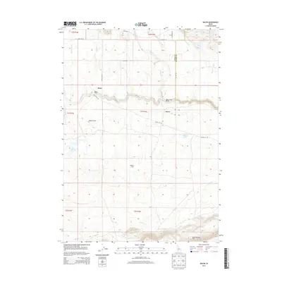
2013 Map of Macon
USGS Topo · Published 2013About this map
Camas Prairie defines the central landscape of this Idaho quadrangle, where the meandering course of Camas Creek links the small settlements of Blaine and Macon. The map illustrates a rural interior shaped by water and transport, featuring two distinct crossings of the creek: the Blaine Bridge and the Macon Sheep Bridge, the latter reflecting the region's historical livestock economy. Elevation increases significantly toward the southern boundary at the Mount Bennett Hills, creating a stark contrast to the level expanses of Macon Flat.
Find a feature on this map
30 named features on this map. Tap any name to fly to it.
Don’t see what you’re looking for? This feature index may not catch every label — zoom into the map to look around manually.
Map Details
Editions of this 2013 Macon Map
This is the sole edition of this map. No revisions or reprints were ever made.
Other maps of this area

1955 · Hailey
USGS Topo · 1:250,000

1957 · Thorn Creek
USGS Topo · 1:62,500

1957 · Bellevue
USGS Topo · 1:62,500

1957 · Blaine
USGS Topo · 1:62,500

1959 · Hailey
USGS Topo · 1:250,000

1962 · Hailey
USGS Topo · 1:250,000

1979 · Summit Reservoir
USGS Topo · 1:24,000
1986 · Thorn Creek Reservoir
USGS Topo · 1:24,000
1986 · Cannonball Mountain
USGS Topo · 1:24,000
1986 · Beaver Creek
USGS Topo · 1:24,000