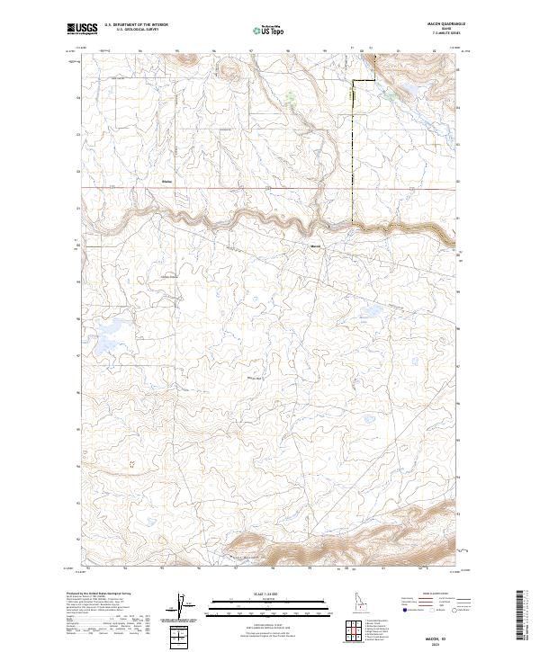
2023 Map of Macon
USGS Topo · Published 2023About this map
Camas Prairie defines the central landscape of this Idaho quadrangle, where the small settlements of Macon and Blaine are connected by a network of rural roads such as Macon Flat Rd and W Side Magic. The geography is characterized by the broad Macon Flat and the rising elevations of the Mount Bennett Hills to the south. Water is a vital element of this high-country terrain, with Camas Creek winding across the northern half, joined by tributaries like Willow Creek and Fricke Creek. To the east, the Camas Co Blaine Co line marks the administrative boundary near Camp Creek. This map captures a classic Western agricultural and ranching landscape where seasonal features like Macon Lake and Chicken Spring underscore the importance of water management in the high desert environment.
Find a feature on this map
22 named features on this map. Tap any name to fly to it.
Don’t see what you’re looking for? This feature index may not catch every label — zoom into the map to look around manually.
Map Details
Editions of this 2023 Macon Map
This is the sole edition of this map. No revisions or reprints were ever made.
Other maps of this area

1955 · Hailey
USGS Topo · 1:250,000

1957 · Thorn Creek
USGS Topo · 1:62,500

1957 · Bellevue
USGS Topo · 1:62,500

1957 · Blaine
USGS Topo · 1:62,500

1959 · Hailey
USGS Topo · 1:250,000

1962 · Hailey
USGS Topo · 1:250,000

1979 · Summit Reservoir
USGS Topo · 1:24,000
1986 · Thorn Creek Reservoir
USGS Topo · 1:24,000
1986 · Cannonball Mountain
USGS Topo · 1:24,000
1986 · Beaver Creek
USGS Topo · 1:24,000