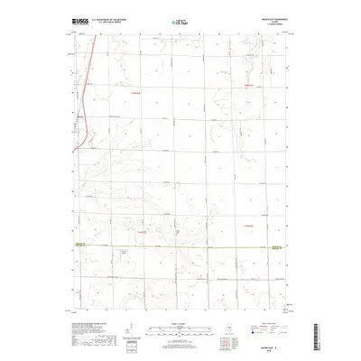
2018 Map of Macon East
USGS Topo · Published 2018About this map
Macon sits along the western edge of this central Illinois landscape, where the prairie transitions into a grid of rural agricultural lands. The territory is defined by the gentle drainage patterns of Finley Cr, Sand Cr, and Willow Br, which carve subtle paths through the township sections. A significant cultural landmark is found at the Long Grove Cem near the banks of Long Grove Cr, a site of genealogical importance for local families. The southern portion of the map identifies the jurisdictional divide between Macon Co and Shelby Co, marked by Hilvety Rd. Small-scale aviation history is noted at the Hilvety Airport, reflecting the local infrastructure of the late 20th and early 21st centuries. The layout of the road network, including routes like W Andrews Street Rd and Riley Rd, illustrates the persistent township-and-range surveying system that has governed this region's development.
Find a feature on this map
49 named features on this map. Tap any name to fly to it.
Don’t see what you’re looking for? This feature index may not catch every label — zoom into the map to look around manually.
Map Details
Editions of this 2018 Macon East Map
This is the sole edition of this map. No revisions or reprints were ever made.
Other maps of this area

1929 · Decatur
USGS Topo · 1:62,500

1933 · Decatur
USGS Topo · 1:62,500

1949 · Dalton City
USGS Topo · 1:62,500

1952 · Assumption
USGS Topo · 1:62,500

1954 · Niantic
USGS Topo · 1:62,500

1958 · Decatur
USGS Topo · 1:250,000

1961 · Decatur
USGS Topo · 1:250,000

1967 · Long Creek
USGS Topo · 1:24,000

1967 · Decatur
USGS Topo · 1:24,000

1982 · Harristown
USGS Topo · 1:24,000