2024 Map of Macon East
USGS Topo · Published 2024About this map
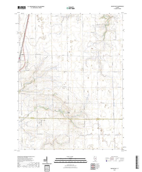
Macon occupies the northwest corner of this Illinois landscape, situated along a primary transportation corridor that defines the western edge of the quadrangle. The terrain is characterized by a series of branching waterways, including Sand Creek, Willow Branch, and the meandering course of Finley Creek to the east. These drainage patterns influenced the rural road network, which largely follows section lines but adjusts for the natural flow of Long Grove Creek as it moves toward the southern border.
Find a feature on this map
43 named features on this map. Tap any name to fly to it.
Don’t see what you’re looking for? This feature index may not catch every label — zoom into the map to look around manually.
Map Details
Editions of this 2024 Macon East Map
This is the sole edition of this map. No revisions or reprints were ever made.
Historical Maps of Macon Through Time
5 maps found