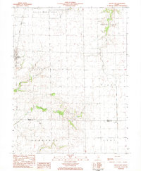
1983 Map of Macon East
USGS Topo · Published 1983About this map
The city of Macon sits at the western edge of this agricultural landscape, where the Illinois Central Gulf railroad runs north-south across the prairie. The map captures a transitional rural environment in the early 1980s, characterized by expansive townships like South Wheatland, Mount Zion, and South Macon. Local aviation is represented by private facilities such as the Snow Landing Strip and Hilvety Airport, reflecting the decentralized nature of travel in the central Illinois plains.
Find a feature on this map
18 named features on this map. Tap any name to fly to it.
Don’t see what you’re looking for? This feature index may not catch every label — zoom into the map to look around manually.
Map Details
Editions of this 1983 Macon East Map
This is the sole edition of this map. No revisions or reprints were ever made.
Other maps of this area

1929 · Decatur
USGS Topo · 1:62,500

1933 · Decatur
USGS Topo · 1:62,500

1949 · Dalton City
USGS Topo · 1:62,500

1952 · Assumption
USGS Topo · 1:62,500

1954 · Niantic
USGS Topo · 1:62,500

1958 · Decatur
USGS Topo · 1:250,000

1961 · Decatur
USGS Topo · 1:250,000

1967 · Long Creek
USGS Topo · 1:24,000

1967 · Decatur
USGS Topo · 1:24,000

1982 · Harristown
USGS Topo · 1:24,000