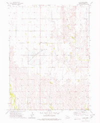
1973 Map of Macon
USGS Topo · Published 1977About this map
Macon serves as the central hub for this Franklin County agricultural landscape, recorded during the early 1970s. The settlement pattern is defined by section-line roads and scattered family landmarks, such as the Schmidt property and the Blauvelt Cem to the northwest. To the southwest of the main settlement, the National Wildlife Management Areas encompass significant wetlands, providing a distinct contrast to the surrounding gridded fields.
Find a feature on this map
16 named features on this map. Tap any name to fly to it.
Don’t see what you’re looking for? This feature index may not catch every label — zoom into the map to look around manually.
Map Details
Editions of this 1973 Macon Map
This is the sole edition of this map. No revisions or reprints were ever made.
Other maps of this area

1896 · Holdrege
USGS Topo · 1:125,000

1897 · Red Cloud
USGS Topo · 1:125,000

1955 · Grand Island
USGS Topo · 1:250,000

1957 · Grand Island
USGS Topo · 1:250,000

1958 · Grand Island
USGS Topo · 1:250,000

1969 · Upland
USGS Topo · 1:24,000

1969 · Upland SE
USGS Topo · 1:24,000
1970 · Hildreth
USGS Topo · 1:24,000
1973 · Republican City NE
USGS Topo · 1:24,000
1973 · Bloomington
USGS Topo · 1:24,000