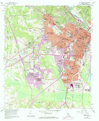
1956 Map of Macon West
USGS Topo · Published 1984About this map
The Ocmulgee River winds along the eastern edge of this mid-century survey, anchoring a landscape where institutional campuses and industrial expansion meet established residential neighborhoods. Educational hubs are prominent throughout the area, from the grounds of Wesleyan College in the northwest to Mercer University near the city center, alongside specialized sites like the Georgia Academy for the Blind. To the south, the massive U S Naval Reservation Ordnance Plant signals the region's mid-century military and industrial importance, situated near the rail corridors of the Central of Georgia Railroad. Local history is deeply etched into the terrain through expansive commemorative spaces such as Rose Hill Cemetery and Macon Memorial Park. The map also traces the growth of South Macon and the smaller enclave of Payne, showing a city transitioning into its suburban era while maintaining its industrial roots at sites like the brickkilns near Terra Cotta.
Find a feature on this map
108 named features on this map. Tap any name to fly to it.
Don’t see what you’re looking for? This feature index may not catch every label — zoom into the map to look around manually.
Map Details
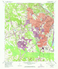
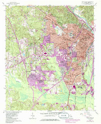
Editions of this 1956 Macon West Map
4 editions found
Other maps of this area

1956 · Fort Valley
USGS Topo · 1:62,500

1956 · Bolingbroke
USGS Topo · 1:62,500

1956 · Warner Robins
USGS Topo · 1:62,500

1956 · Macon West
USGS Topo · 1:24,000

1956 · Macon East
USGS Topo · 1:24,000

1956 · Macon
USGS Topo · 1:62,500

1957 · Macon
USGS Topo · 1:250,000

1958 · Macon
USGS Topo · 1:250,000

1964 · Macon
USGS Topo · 1:250,000
1973 · Macon NE
USGS Topo · 1:24,000