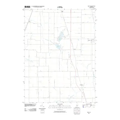
2010 Map of Macy
USGS Topo · Published 2010About this map
Nyona Lake and South Mud Lake define the central landscape of this Miami County quadrangle, where a complex network of artificial drainage ditches supports the local agricultural economy. These waterways, including Smith Ditch and Zanger Ditch, demonstrate the engineering required to manage the wetlands surrounding Mud Creek and its southern branch. Small settlements are scattered across the grid, from Green Oak in the north to Perrysburg in the south, while the village of Macy sits near the eastern border.
Find a feature on this map
34 named features on this map. Tap any name to fly to it.
Don’t see what you’re looking for? This feature index may not catch every label — zoom into the map to look around manually.
Map Details
Editions of this 2010 Macy Map
This is the sole edition of this map. No revisions or reprints were ever made.
Other maps of this area

1951 · Peru
USGS Topo · 1:24,000

1951 · Twelve Mile
USGS Topo · 1:24,000

1953 · Chicago
USGS Topo · 1:250,000

1953 · Danville
USGS Topo · 1:250,000

1955 · Danville
USGS Topo · 1:250,000

1955 · Logansport
USGS Topo · 1:24,000

1956 · Danville
USGS Topo · 1:250,000

1957 · Chicago
USGS Topo · 1:250,000
1960 · Peru
USGS Topo · 1:24,000

1960 · Fulton
USGS Topo · 1:24,000