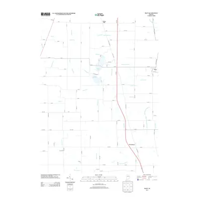
2013 Map of Macy
USGS Topo · Published 2013About this map
Agricultural fields and a sophisticated network of drainage ditches characterize this portion of northern Indiana, centered on the village of Macy. The landscape is defined by its water management, with numerous named waterways such as Clemans Smith Ditch, Weaver Davis Ditch, and Zanger Ditch facilitating the cultivation of the surrounding plains. These features often bear the names of local families, providing a direct link to the area's genealogical history and land ownership patterns.
Find a feature on this map
104 named features on this map. Tap any name to fly to it.
Don’t see what you’re looking for? This feature index may not catch every label — zoom into the map to look around manually.
Map Details
Editions of this 2013 Macy Map
This is the sole edition of this map. No revisions or reprints were ever made.
Other maps of this area

1951 · Peru
USGS Topo · 1:24,000

1951 · Twelve Mile
USGS Topo · 1:24,000

1953 · Chicago
USGS Topo · 1:250,000

1953 · Danville
USGS Topo · 1:250,000

1955 · Danville
USGS Topo · 1:250,000

1955 · Logansport
USGS Topo · 1:24,000

1956 · Danville
USGS Topo · 1:250,000

1957 · Chicago
USGS Topo · 1:250,000
1960 · Peru
USGS Topo · 1:24,000

1960 · Fulton
USGS Topo · 1:24,000