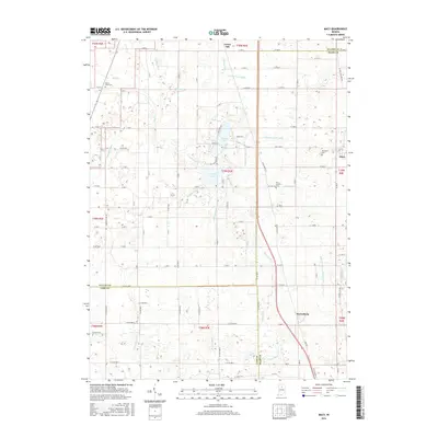
2016 Map of Macy
USGS Topo · Published 2016About this map
Nyona Lake and S Mud Lake anchor this agricultural landscape at the intersection of Miami, Fulton, and Cass counties. The village of Macy sits on the eastern edge of the survey, where the local road network funnels toward the community. The land is defined by an extensive system of drainage, including Miller Ditch, Weaver Davis Ditch, and Fenters Ditch, illustrating the managed hydrology required for the region's farming economy. In the south, the settlement of Perrysburg marks a significant crossroads near the headwaters of Mills Ditch. Genealogists will find several notable burial sites scattered across the townships, from Mount Olive Cem in the northwest to the Plainview Cem near Macy. The map also traces the path of N Old Route 31, which serves as a primary north-south corridor through the central plains, connecting small hamlets like Green Oak to the larger regional centers.
Find a feature on this map
92 named features on this map. Tap any name to fly to it.
Don’t see what you’re looking for? This feature index may not catch every label — zoom into the map to look around manually.
Map Details
Editions of this 2016 Macy Map
This is the sole edition of this map. No revisions or reprints were ever made.
Other maps of this area

1951 · Peru
USGS Topo · 1:24,000

1951 · Twelve Mile
USGS Topo · 1:24,000

1953 · Chicago
USGS Topo · 1:250,000

1953 · Danville
USGS Topo · 1:250,000

1955 · Danville
USGS Topo · 1:250,000

1955 · Logansport
USGS Topo · 1:24,000

1956 · Danville
USGS Topo · 1:250,000

1957 · Chicago
USGS Topo · 1:250,000
1960 · Peru
USGS Topo · 1:24,000

1960 · Fulton
USGS Topo · 1:24,000