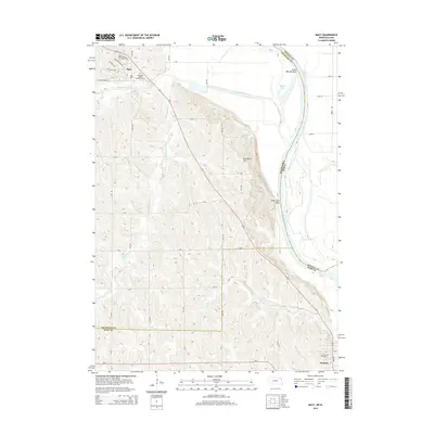
2014 Map of Macy
USGS Topo · Published 2014About this map
Macy serves as a central hub on the reservation in this 2014 survey, where the Nebraska Indian Community Coll and the Omaha Tribal Cem are established near the rugged bluffs of the Missouri River. The landscape is defined by the sharp transition from the elevated, creek-carved loess hills to the wide alluvial plain of the river. Significant landmarks like Blackbird Hill and Black Bird Bend overlook the water, documenting a geography where the river's historic shifts created features such as Badger Lake and Lower Monona Bend. Further south, the town of Decatur sits at the edge of the Monona and Burt County line, near Hillcrest Cem. The map traces numerous local drainages including Wood Cr and both the North and South Blackbird Creek forks, illustrating the complex hydrology that feeds into the Missouri valley.
Find a feature on this map
39 named features on this map. Tap any name to fly to it.
Don’t see what you’re looking for? This feature index may not catch every label — zoom into the map to look around manually.
Map Details
Editions of this 2014 Macy Map
This is the sole edition of this map. No revisions or reprints were ever made.
Other maps of this area

1955 · Sioux City
USGS Topo · 1:250,000

1955 · Fremont
USGS Topo · 1:250,000

1957 · Fremont
USGS Topo · 1:250,000

1958 · Sioux City
USGS Topo · 1:250,000

1958 · Fremont
USGS Topo · 1:250,000

1959 · Sioux City
USGS Topo · 1:250,000

1966 · Lyons
USGS Topo · 1:24,000

1966 · Walthill SW
USGS Topo · 1:24,000

1966 · Walthill
USGS Topo · 1:24,000

1966 · Macy
USGS Topo · 1:24,000