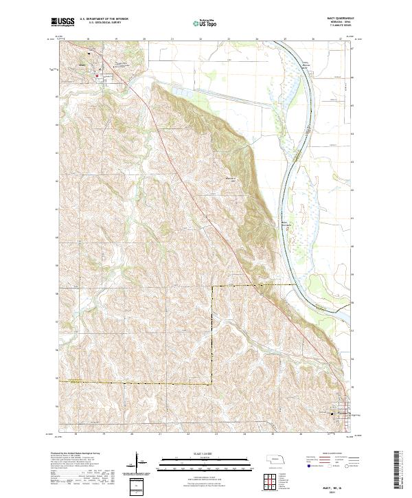
2021 Map of Macy
USGS Topo · Published 2021About this map
Macy serves as a cultural and educational anchor in this Nebraska landscape, home to the Nebraska Indian Community College Macy Campus and the Umo Ho Tribal Cem. The terrain is defined by the winding course of the Missouri River, which forms the boundary between Nebraska and Iowa. The river's historical shifts are evident in landmarks like Lower Monona Bend and Black Bird Bend, where the water has shaped the bluffs and bottoms over generations.
Find a feature on this map
33 named features on this map. Tap any name to fly to it.
Don’t see what you’re looking for? This feature index may not catch every label — zoom into the map to look around manually.
Map Details
Editions of this 2021 Macy Map
This is the sole edition of this map. No revisions or reprints were ever made.
Other maps of this area

1955 · Sioux City
USGS Topo · 1:250,000

1955 · Fremont
USGS Topo · 1:250,000

1957 · Fremont
USGS Topo · 1:250,000

1958 · Sioux City
USGS Topo · 1:250,000

1958 · Fremont
USGS Topo · 1:250,000

1959 · Sioux City
USGS Topo · 1:250,000

1966 · Lyons
USGS Topo · 1:24,000

1966 · Walthill SW
USGS Topo · 1:24,000

1966 · Walthill
USGS Topo · 1:24,000

1966 · Macy
USGS Topo · 1:24,000