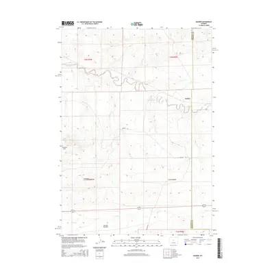
2015 Map of Madden
USGS Topo · Published 2015About this map
Madden sits at the intersection of high plains drainage systems where the Alkali Cr winds through the landscape. This 2015 survey captures a quiet portion of Wyoming near the Fremont and Natrona County line, characterized by its wide-reaching draws and intermittent water sources. The landscape is defined by geological features like Frenchie Draw and the South Fork Frenchie Draw, while human presence is marked by sparse infrastructure such as Frenchie Dr and Deer Creek Rd. To the south, Poison Cr and the open area of Merriam Meadows suggest a region utilized for ranching or grazing. The presence of the Alkali Reservoir indicates the critical importance of water management in this arid environment, providing a essential point of reference for land use in this specific corner of Wyoming.
Find a feature on this map
14 named features on this map. Tap any name to fly to it.
Don’t see what you’re looking for? This feature index may not catch every label — zoom into the map to look around manually.
Map Details
Editions of this 2015 Madden Map
This is the sole edition of this map. No revisions or reprints were ever made.
Other maps of this area

1952 · Seventy-one Reservoir
USGS Topo · 1:24,000

1952 · Moneta
USGS Topo · 1:24,000

1952 · Badwater
USGS Topo · 1:24,000

1952 · Lysite
USGS Topo · 1:24,000

1952 · Arminto SW
USGS Topo · 1:24,000

1952 · Madden
USGS Topo · 1:24,000

1952 · Arminto NW
USGS Topo · 1:24,000

1952 · Lysite SE
USGS Topo · 1:24,000

1952 · Moneta SE
USGS Topo · 1:24,000

1955 · Arminto
USGS Topo · 1:250,000