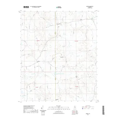
2020 Map of Madden
USGS Topo · Published 2020About this map
Laurel Hill and Madden serve as focal points in this section of central Mississippi, where the border between Leake Co and Neshoba Co divides a landscape defined by small rural settlements and winding watercourses. The area is marked by a network of local roads such as Laurel Hill Rd and Madden Rd, which connect several family and community landmarks. Researchers will find a high density of historic burial sites, including Laurel Hill Cem and Mount Zion Cem, often situated near the headwaters of local streams.
Find a feature on this map
74 named features on this map. Tap any name to fly to it.
Don’t see what you’re looking for? This feature index may not catch every label — zoom into the map to look around manually.
Map Details
Editions of this 2020 Madden Map
This is the sole edition of this map. No revisions or reprints were ever made.
Other maps of this area

1953 · Meridian
USGS Topo · 1:250,000

1957 · Meridian
USGS Topo · 1:250,000

1962 · Edinburg
USGS Topo · 1:62,500

1965 · Meridian
USGS Topo · 1:250,000

1972 · Pearl River
USGS Topo · 1:24,000

1972 · McAfee
USGS Topo · 1:24,000

1972 · Madden
USGS Topo · 1:24,000
1972 · Sebastopol
USGS Topo · 1:24,000
1972 · McDonald
USGS Topo · 1:24,000
1972 · Union West
USGS Topo · 1:24,000