1958 Map of Madison Junction
USGS Topo · Published 1959About this map
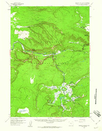
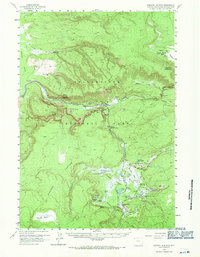
Madison Junction serves as the focal point for this 1958 survey of Yellowstone National Park, where the Gibbon River and Firehole River converge to form the Madison River. This landscape is dominated by geothermal activity, notably within the Midway Geyser Basin and Lower Geyser Basin. Famous hydrothermal features like the Grand Prismatic Spring, Excelsior Geyser Crater, and Great Fountain Geyser are meticulously documented alongside smaller features such as Queens Laundry and Morning Mist Springs.
Find a feature on this map
61 named features on this map. Tap any name to fly to it.
Don’t see what you’re looking for? This feature index may not catch every label — zoom into the map to look around manually.
Map Details
Editions of this 1958 Madison Junction Map
2 editions found
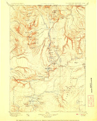
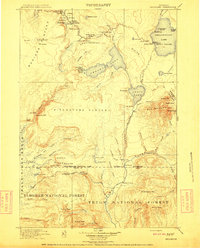
Other maps of this area

1885 · Gallatin
USGS Topo · 1:125,000

1885 · Gallatin
USGS Topo · 1:125,000

1886 · Shoshone
USGS Topo · 1:125,000

1888 · Shoshone
USGS Topo · 1:125,000

1895 · Shoshone
USGS Topo · 1:125,000

1901 · Shoshone
USGS Topo · 1:125,000

1901 · Gallatin
USGS Topo · 1:125,000
1908 · Gallatin
USGS Topo · 1:125,000

1908 · Shoshone
USGS Topo · 1:125,000
1911 · Shoshone
USGS Topo · 1:125,000