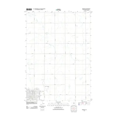
2012 Map of Madison
USGS Topo · Published 2012About this map
Dakota State University serves as a prominent institutional anchor in this 2012 depiction of the Lake County seat. The grid-based urban layout of Madison is visible in the southwestern quadrant, where the campus and residential streets like N Josephine Ave meet the open agricultural landscape. To the northeast, Graceland Cem and the Madison Municipal Airport transition the town into the surrounding prairie. The natural hydrology is defined by the winding paths of Battle Cr and Park Cr, which cut through the rectilinear township and range system. This survey illustrates the modern intersection of a historic prairie college town with the essential transport infrastructure of the 21st century, showing how the local road network, including E Center St, integrates with the broader regional section lines.
Find a feature on this map
41 named features on this map. Tap any name to fly to it.
Don’t see what you’re looking for? This feature index may not catch every label — zoom into the map to look around manually.
Map Details
Editions of this 2012 Madison Map
This is the sole edition of this map. No revisions or reprints were ever made.
Other maps of this area

1953 · Watertown
USGS Topo · 1:250,000

1955 · Sioux Falls
USGS Topo · 1:250,000

1958 · Sioux Falls
USGS Topo · 1:250,000

1958 · Watertown
USGS Topo · 1:250,000

1968 · Lake Madison
USGS Topo · 1:24,000

1968 · Wentworth
USGS Topo · 1:24,000

1968 · Ramona
USGS Topo · 1:24,000

1968 · Madison
USGS Topo · 1:24,000

1968 · Sinai
USGS Topo · 1:24,000

1968 · Lake Herman
USGS Topo · 1:24,000