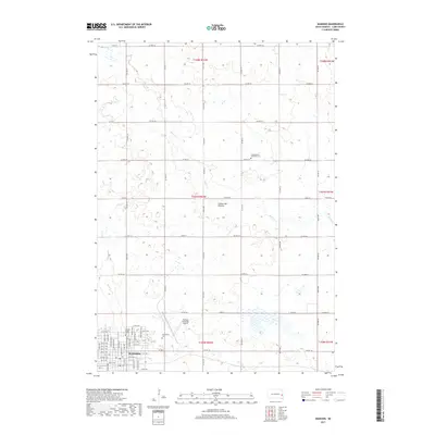
2017 Map of Madison
USGS Topo · Published 2017About this map
Madison stands as a significant regional hub in Lake County, characterized by the presence of Dakota State Univ and the Madison Municipal Airport. The city's street grid is meticulously detailed, showing the layout from Center St W up through 11th St NE, while Graceland Cem sits on the eastern edge of the settlement. The surrounding landscape is defined by the Coteau des Prairies upland, where the terrain is marked by numerous small depressions and drainage patterns. Water features like Battle Cr and Park Cr wind through the township sections, illustrating the agricultural and hydrologic character of this part of South Dakota. To the north, the Lake Madison Lutheran Cem provides a specific point of interest for genealogists tracing family roots in the rural sections beyond the city limits.
Find a feature on this map
58 named features on this map. Tap any name to fly to it.
Don’t see what you’re looking for? This feature index may not catch every label — zoom into the map to look around manually.
Map Details
Editions of this 2017 Madison Map
This is the sole edition of this map. No revisions or reprints were ever made.
Other maps of this area

1953 · Watertown
USGS Topo · 1:250,000

1955 · Sioux Falls
USGS Topo · 1:250,000

1958 · Sioux Falls
USGS Topo · 1:250,000

1958 · Watertown
USGS Topo · 1:250,000

1968 · Lake Madison
USGS Topo · 1:24,000

1968 · Wentworth
USGS Topo · 1:24,000

1968 · Ramona
USGS Topo · 1:24,000

1968 · Madison
USGS Topo · 1:24,000

1968 · Sinai
USGS Topo · 1:24,000

1968 · Lake Herman
USGS Topo · 1:24,000