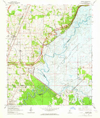
1963 Map of Madison
USGS Topo · Published 1964About this map
The Ross Barnett Reservoir dominates the eastern landscape in this early 1960s study, with blue hatching indicating vast areas along the Pearl River and Pelahatchie Creek designated to be submerged. The mapping captures a critical moment of transformation for the region, balancing the rising waters of the reservoir with established terrestrial landmarks like Barnes Prairie and the Natchez Trace Parkway.
Find a feature on this map
50 named features on this map. Tap any name to fly to it.
Don’t see what you’re looking for? This feature index may not catch every label — zoom into the map to look around manually.
Map Details
Editions of this 1963 Madison Map
3 editions found
Other maps of this area

1903 · Jackson
USGS Topo · 1:125,000

1905 · Jackson
USGS Topo · 1:48,000

1908 · Jackson
USGS Topo · 1:62,500

1922 · Pelahatchee
USGS Topo · 1:48,000

1924 · Pelahatchee
USGS Topo · 1:62,500

1950 · Pelahatchie
USGS Topo · 1:62,500

1952 · Pelahatchie
USGS Topo · 1:62,500

1953 · Meridian
USGS Topo · 1:250,000

1955 · Jackson
USGS Topo · 1:250,000

1957 · Meridian
USGS Topo · 1:250,000