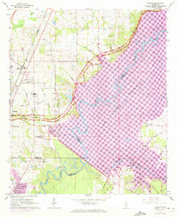
1963 Map of Madison
USGS Topo · Published 1972About this map
The sprawling waters of the Ross Barnett Reservoir dominate the eastern landscape of this early 1960s survey, illustrating a period of significant hydrological and suburban change north of Jackson. The transition from rural farmland to residential development is evident in the growth of Madison and Ridgeland, both situated along the Illinois Central corridor. The map preserves the locations of many local landmarks from this era, including Bennett Chapel, Pearl River Ch, and the Ridgeland Sch. Transportation patterns are anchored by the Natchez Trace Parkway as it winds alongside the Pearl River, while the presence of the Bruce Campbell Airport and the Jackson Country Club reflects the region's mid-century expansion. This record also identifies several family and community burial grounds, such as Jessamine Cem, Haley Cem, and Jones Cem, which provide essential touchstones for local genealogical research.
Find a feature on this map
44 named features on this map. Tap any name to fly to it.
Don’t see what you’re looking for? This feature index may not catch every label — zoom into the map to look around manually.
Map Details
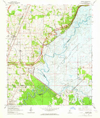
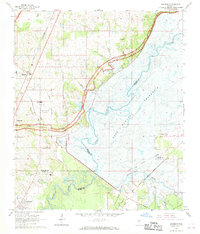
Editions of this 1963 Madison Map
3 editions found
Other maps of this area

1903 · Jackson
USGS Topo · 1:125,000

1905 · Jackson
USGS Topo · 1:48,000

1908 · Jackson
USGS Topo · 1:62,500

1922 · Pelahatchee
USGS Topo · 1:48,000

1924 · Pelahatchee
USGS Topo · 1:62,500

1950 · Pelahatchie
USGS Topo · 1:62,500

1952 · Pelahatchie
USGS Topo · 1:62,500

1953 · Meridian
USGS Topo · 1:250,000

1955 · Jackson
USGS Topo · 1:250,000

1957 · Meridian
USGS Topo · 1:250,000