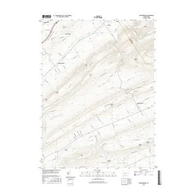
2016 Map of Madisonburg
USGS Topo · Published 2016About this map
Madisonburg and Hublersburg anchor the valley floors in this central Pennsylvania landscape, where the ridge-and-valley topography dictates the flow of commerce and water. The terrain is defined by the massive spine of Nittany Mtn and Brush Mtn, separating Little Sugar Valley from Penns Valley. Movement through these steep ridges is limited to strategic breaks like Lees Gap, Markle Gap, and Gingerich Gap, which connect the small farming hamlets. Along the southern edge of the survey, Penns Cr flows near the Penns Cave Airport, while to the north, Little Fishing Cr drains the Little Nittany Valley. The map records a dense network of rural roads such as Rag Valley Rd and Little Sugar Valley Rd that trace the base of the mountains, linking longtime settlements like Nittany, Snydertown, and Jacksonville.
Find a feature on this map
85 named features on this map. Tap any name to fly to it.
Don’t see what you’re looking for? This feature index may not catch every label — zoom into the map to look around manually.
Map Details
Editions of this 2016 Madisonburg Map
This is the sole edition of this map. No revisions or reprints were ever made.
Other maps of this area

1921 · Howard
USGS Topo · 1:48,000

1921 · Lock Haven
USGS Topo · 1:62,500

1923 · Howard
USGS Topo · 1:62,500

1923 · Lock Haven
USGS Topo · 1:62,500

1924 · Centre Hall
USGS Topo · 1:62,500

1929 · Centre Hall
USGS Topo · 1:62,500

1937 · Millheim
USGS Topo · 1:48,000

1941 · Millheim
USGS Topo · 1:62,500

1943 · Lewistown
USGS Topo · 1:125,000

1944 · Lock Haven
USGS Topo · 1:62,500