1977 Map of Madisonburg
USGS Topo · Published 1979About this map
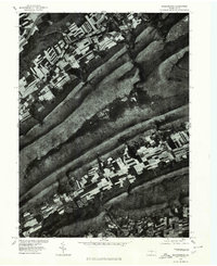
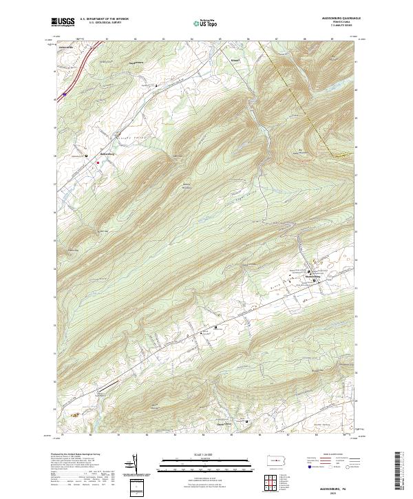
Nittany Mountain and Brush Mountain dominate this late-1970s orthophotograph, providing a stark visual of the ridge-and-valley province in Centre County. Unlike traditional topographic maps, this imagery, produced in cooperation with the Soil Conservation Service, uses rectified aerial photography to show the exact footprint of agricultural fields and forest cover. The settlement of Madisonburg sits in the fertile stretch of Penn s Valley, where the linear patterns of farmsteads contrast with the dense woods of the surrounding peaks. To the north, Fishing Creek winds through the landscape near the edge of Snow Shoe, illustrating the relationship between water sources and early Pennsylvania development. This format is particularly useful for researchers identifying old fence lines, woodlots, and the precise 1977 extent of the built environment in this rural corridor.
Find a feature on this map
6 named features on this map. Tap any name to fly to it.
Don’t see what you’re looking for? This feature index may not catch every label — zoom into the map to look around manually.
Map Details
Editions of this 1977 Madisonburg Map
This is the sole edition of this map. No revisions or reprints were ever made.
Historical Maps of Walker Township Through Time
7 maps found
Featured Locations
- Walker Township, PA
- Porter Township, PA
- Logan Township, PA
- Madisonburg, Miles Township
- Nittany, Walker Township