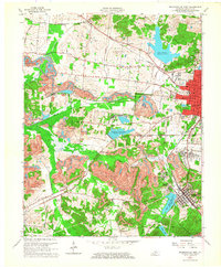
1962 Map of Madisonville West
USGS Topo · Published 1964About this map
Madisonville anchor the eastern edge of this 1962 topographic record, serving as a hub for the sprawling extractive industry that defined the Hopkins County landscape. Extensive Strip Mine operations dominate the central and southern terrain, carving through the hills between Manitou and Richland. These industrial scars contrast with the numerous water management features like Lake Peewee and Pleasant View Lake, which likely supported both the growing urban population and the local coal works.
Find a feature on this map
46 named features on this map. Tap any name to fly to it.
Don’t see what you’re looking for? This feature index may not catch every label — zoom into the map to look around manually.
Map Details
Editions of this 1962 Madisonville West Map
2 editions found
Other maps of this area

1907 · Earlington
USGS Topo · 1:48,000

1909 · Dawson Springs
USGS Topo · 1:48,000

1909 · Earlington
USGS Topo · 1:62,500

1909 · Madisonville
USGS Topo · 1:62,500

1911 · Dawson Springs
USGS Topo · 1:62,500

1912 · Nortonville
USGS Topo · 1:62,500

1952 · Hanson
USGS Topo · 1:24,000

1953 · Nortonville
USGS Topo · 1:24,000

1953 · Madisonville East
USGS Topo · 1:24,000

1954 · Evansville
USGS Topo · 1:250,000