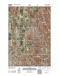
2011 Map of Madras East
USGS Topo · Published 2011About this map
Madras serves as the focal point for this high-desert landscape in Jefferson County, appearing as a developed grid at the southwestern corner of the sheet. The terrain to the north and east is defined by a series of dramatic geographic features including Red Shed Canyon, Dewies Canyon, and Coleman Canyon. Much of the local water system is tied to the meandering path of Mud Springs Creek and the North Unit Main Canal, which support agricultural land near the small settlement of Paxton. Genealogists and local historians will find the Mount Jefferson IOOF Cemetery clearly marked on the outskirts of town. The high plateau character is further emphasized by landmarks like Fox Corral and several isolated springs, such as Schmoker Spring and Monner Spring, which represent vital water sources in this arid region of Central Oregon.
Find a feature on this map
43 named features on this map. Tap any name to fly to it.
Don’t see what you’re looking for? This feature index may not catch every label — zoom into the map to look around manually.
Map Details
Editions of this 2011 Madras East Map
This is the sole edition of this map. No revisions or reprints were ever made.
Other maps of this area

1928 · Madras
USGS Topo · 1:125,000

1931 · Madras
USGS Topo · 1:125,000

1955 · Bend
USGS Topo · 1:250,000

1957 · Bend
USGS Topo · 1:250,000

1958 · Bend
USGS Topo · 1:250,000

1962 · Eagle Butte
USGS Topo · 1:24,000

1962 · Gateway
USGS Topo · 1:24,000
1963 · Culver
USGS Topo · 1:24,000
1963 · Madras West
USGS Topo · 1:24,000
1963 · Madras East
USGS Topo · 1:24,000