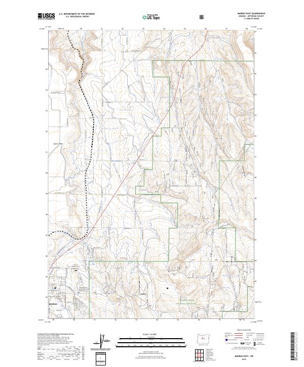
2023 Map of Madras East
USGS Topo · Published 2023About this map
Agency Plains and the northern reaches of Madras anchor this landscape where high desert plateaus meet deep-cut drainages. The Mount Jefferson IOOF Cem sits at the edge of the urban boundary, serving as a significant landmark for local family historians. Educational development is represented by the Central Oregon Community College Madras Campus, reflecting the modern expansion of the community into the surrounding terrain.
Find a feature on this map
39 named features on this map. Tap any name to fly to it.
Don’t see what you’re looking for? This feature index may not catch every label — zoom into the map to look around manually.
Map Details
Editions of this 2023 Madras East Map
This is the sole edition of this map. No revisions or reprints were ever made.
Other maps of this area

1928 · Madras
USGS Topo · 1:125,000

1931 · Madras
USGS Topo · 1:125,000

1955 · Bend
USGS Topo · 1:250,000

1957 · Bend
USGS Topo · 1:250,000

1958 · Bend
USGS Topo · 1:250,000

1962 · Eagle Butte
USGS Topo · 1:24,000

1962 · Gateway
USGS Topo · 1:24,000
1963 · Culver
USGS Topo · 1:24,000
1963 · Madras West
USGS Topo · 1:24,000
1963 · Madras East
USGS Topo · 1:24,000