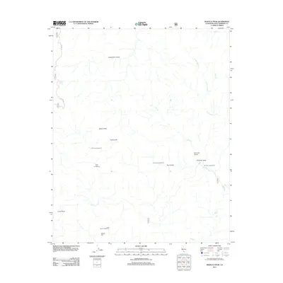
2012 Map of Madulce Peak
USGS Topo · Published 2012About this map
Madulce Peak stands as the central landmark of this high-elevation terrain in Santa Barbara County, where the headwaters of Mono Cr and Rancho Nuevo Cr carve through deep canyons. This portion of the backcountry is defined by its remote recreational character, mapped with several specialized campsites including Dutch Oven Campground, Bill Farris Campground, and Pine Canyon Campground. The landscape transitions from the high ridges of Loma Pelona and Alamar Hill down into Don Victor Valley, a prominent geographic feature in the eastern section of the map. Access is limited primarily to the winding path of Big Pine Rd and numerous unnamed trails, reflecting a wilderness managed for conservation and seasonal travel. The presence of Choke Cherry Spring and seasonal watercourses like Bear Cr indicates the critical role of water sources for both wildlife and travelers in this arid upland environment.
Find a feature on this map
19 named features on this map. Tap any name to fly to it.
Don’t see what you’re looking for? This feature index may not catch every label — zoom into the map to look around manually.
Map Details
Editions of this 2012 Madulce Peak Map
This is the sole edition of this map. No revisions or reprints were ever made.
Other maps of this area

1902 · Santa Ynez
USGS Topo · 1:125,000

1903 · Mt. Pinos
USGS Topo · 1:125,000

1905 · Santa Ynez
USGS Topo · 1:125,000

1942 · Little Pine Mountain
USGS Topo · 1:24,000

1943 · Big Pine Mountain
USGS Topo · 1:31,680

1943 · Rancho Nuevo Creek
USGS Topo · 1:24,000

1943 · Old Man Mountain
USGS Topo · 1:24,000

1943 · Cuyama Peak
USGS Topo · 1:24,000

1943 · Hildreth Peak
USGS Topo · 1:24,000
1943 · Fox Mountain
USGS Topo · 1:24,000