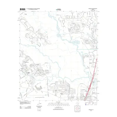
2013 Map of Maedan
USGS Topo · Published 2013About this map
The W Fork San Jacinto River and its confluence with Spring Cr dominate the central landscape of this 2013 survey, illustrating the complex suburban geography north of Houston. Residential developments like Kingwood, Birnham Wood, and Sandpiper Village are shown in high detail, reflecting the rapid expansion of Harris County communities during the early 21st century. The proximity of the George Bush Intercontinental/Houston Airport to the south influenced the area's growth, while the northern reaches maintain a more dissected appearance near Woodsons Gully.
Find a feature on this map
244 named features on this map. Tap any name to fly to it.
Don’t see what you’re looking for? This feature index may not catch every label — zoom into the map to look around manually.
Map Details
Editions of this 2013 Maedan Map
This is the sole edition of this map. No revisions or reprints were ever made.
Other maps of this area

1916 · Aldine
USGS Topo · 1:24,000

1916 · Harmaston
USGS Topo · 1:24,000

1916 · Moonshine Hill
USGS Topo · 1:24,000

1916 · Humble
USGS Topo · 1:24,000

1916 · Spring
USGS Topo · 1:24,000

1919 · Aldine
USGS Topo · 1:31,680

1919 · Humble
USGS Topo · 1:31,680

1919 · Weeden
USGS Topo · 1:31,680

1920 · Spring
USGS Topo · 1:31,680

1920 · Harmaston
USGS Topo · 1:31,680