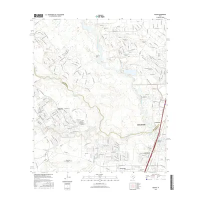
2016 Map of Maedan
USGS Topo · Published 2016About this map
George Bush Intercontinental/Houston Airport dominates the southern landscape of this 2016 survey, illustrating the modern aviation infrastructure that serves the greater Houston metropolitan area. The map documents a complex suburban geography where the boundary between Montgomery and Harris counties meets at the confluence of several major waterways. The West Fork San Jacinto River flows southward into Lake Houston, joined by Spring Creek and Cypress Creek. This hydrological network defines the local topography, punctuated by features like Woodsons Gully and Black Slough. Residential developments and named thoroughfares such as Rayford Rd and Riley Fuzzell Rd connect established communities like Spring, Humble, and Kingwood. The survey provides a precise look at the 21st-century growth patterns where traditional Texas watercourses meet expanding transport hubs like the State Highway 35 Bridge.
Find a feature on this map
226 named features on this map. Tap any name to fly to it.
Don’t see what you’re looking for? This feature index may not catch every label — zoom into the map to look around manually.
Map Details
Editions of this 2016 Maedan Map
This is the sole edition of this map. No revisions or reprints were ever made.
Other maps of this area

1916 · Aldine
USGS Topo · 1:24,000

1916 · Harmaston
USGS Topo · 1:24,000

1916 · Moonshine Hill
USGS Topo · 1:24,000

1916 · Humble
USGS Topo · 1:24,000

1916 · Spring
USGS Topo · 1:24,000

1919 · Aldine
USGS Topo · 1:31,680

1919 · Humble
USGS Topo · 1:31,680

1919 · Weeden
USGS Topo · 1:31,680

1920 · Spring
USGS Topo · 1:31,680

1920 · Harmaston
USGS Topo · 1:31,680