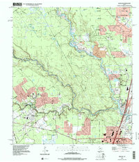
1995 Map of Maedan
USGS Topo · Published 1999About this map
The West Fork San Jacinto River carves a winding path through this region of the Texas Gulf Coast, meeting the confluence of Spring Creek and Cypress Creek as they flow toward Lake Houston. This 1995 survey captures the rapid suburban development encroaching upon the river bottoms, with residential neighborhoods like Kingwood and Northshire expanding alongside established communities such as Humble and Bordersville. The landscape is dotted with numerous small ponds and depressions, including Mule Pen Pond and Little Alligator Pond, which reflect the low-lying, swampy character of the terrain before it reaches the larger reservoir.
Find a feature on this map
70 named features on this map. Tap any name to fly to it.
Don’t see what you’re looking for? This feature index may not catch every label — zoom into the map to look around manually.
Map Details
Editions of this 1995 Maedan Map
This is the sole edition of this map. No revisions or reprints were ever made.
Other maps of this area

1916 · Aldine
USGS Topo · 1:24,000

1916 · Harmaston
USGS Topo · 1:24,000

1916 · Moonshine Hill
USGS Topo · 1:24,000

1916 · Humble
USGS Topo · 1:24,000

1916 · Spring
USGS Topo · 1:24,000

1919 · Aldine
USGS Topo · 1:31,680

1919 · Humble
USGS Topo · 1:31,680

1919 · Weeden
USGS Topo · 1:31,680

1920 · Spring
USGS Topo · 1:31,680

1920 · Harmaston
USGS Topo · 1:31,680